SATELLITE IMAGE OF HURRICANE ISABEL
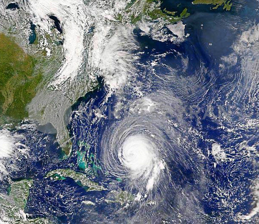
Satellite image of Hurricane Isabel over the Atlantic Ocean, September 15, 2003. U.S. East Coast residents prepared Monday for one of the most powerful storms in recent memory as Hurricane Isabel whirled through the Atlantic toward possible landfall September 18 in North Carolina. Isabel's top winds weakened slightly to 125 mph (205 kph) as it took a path that could bring it ashore near Cape Hatteras, North Carolina, and north along the Chesapeake Bay near Washington D.C., through Virginia, Maryland and Pennsylvania, the U.S. National Hurricane Center said. FOR EDITORIAL USE ONLY NO SALESREUTERS/Image courtesy: NASA/Orbimage