US-EL NINO
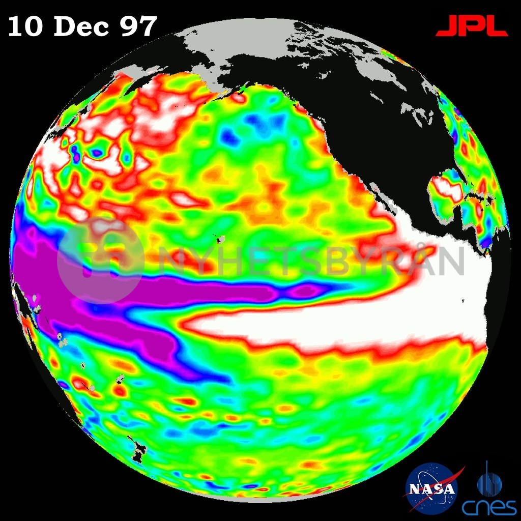
This 10 December image released by NASA and the Jet Propulsion Lab 18 December of the Earth taken by the US-French TOPEX/Poseidon satellite shows sea surface height relative to normal ocean conditions. Sea surface height is an indicator of the heat content of the ocean. The volume and area of the warm water pool related to El Nino has increased again after reaching a temporary low around 01 December. AFP PHOTO/JPL/NASA