SATELLITE WEATHER MAP OF HURRICANE GEORGES
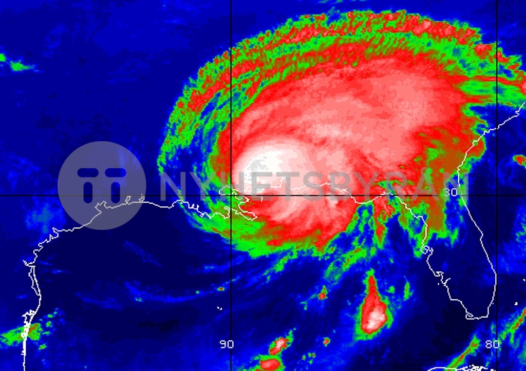
WAS02:WEATHER-GEORGES:BILOXI,MISSISSIPPI,28SEP98 - Storm centered infrared image of Hurricane Georges as it slams into the states bordering the Gulf of Mexico, November 28. Furious winds and driving rain pounded the Mississippi coast as Hurricane Georges swept ashore from the Gulf. Wind gusts of up to 170 mph (273 kph) were reported in Biloxi, Mississippi where the eye of the deadly storm crossed on to land. hb/Photo by NOAA REUTERS